
Location
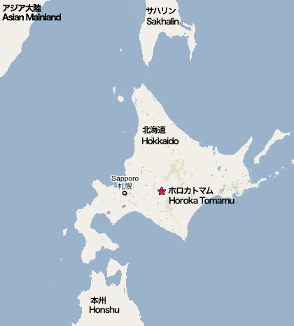
Horoka Tomamu is in the centre of Hokkaido, the northern island of Japan. The map coordinates are E 142.51339 N 43.10089.
Administratively, it is in Shimukappu, a mura* not far from the southwest corner of Daisetsuzan National Park. Horoka Tomamu is at the northern end of the Hidaka Mountain Range, 15 kilometres (9 miles) from the Tomamu ski resort.
Sapporo is 151 km (94 miles) by road, Asahikawa 113 km (70 miles), and Obihiro 72 km (45 miles).
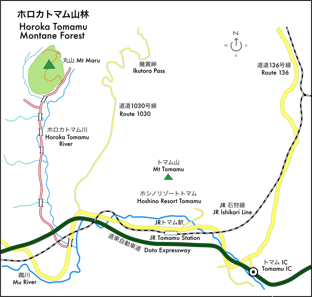
Local access to the Horoka Tomamu Montane Forest is via a 5-kilometre (3 mile) gravel track (indicated by a double red line above) from the main Route 136 road (indicated in yellow). (Route 136 joins Tomamu, in the east, with the main settlement of Shimukappu, in the west.)
*Mura is usually translated as 'village' in English but it means something more like a small (Anglo-American) 'county'. (Shimukappu has an area of 570 square kilometres, similar to Clay County, North Carolina.)
SCH, 13 July 2012